The mountains are calling! I have time, the weather forecast is good and a crazy route is thought out. The idea is to hike from Innsbruck to a hut near the Italian border and to possibly climb a +3000m in the area. All in all I am giving myself four days for this adventure. It is Monday, shops are finally open and I need to run around to pick up a few things for the trip.
Day 1: Monday 30.10.17 – Igls to Glungezerhütte
Everything in my backpack to last me about four days in the mountains, packed and ready in the early afternoon. I am self sufficient. Just as the sun is setting I jump into bus J heading for the Patscherkofelbahn. It is pretty crowded in the bus and I barely fit in with my pack. People are also looking at me a bit strangely, probably wondering who in his right mind is heading out hiking in the dark.
I start walking from Igls (870m) at around 18:00. It is dark, but thankfully I know the track pretty well, having hiked it a couple weeks earlier. I meet a couple people early on heading down, but otherwise there is no one. In a couple hours I pass by Lanser Alm (1735m) and refill my water, as it is the last place for running water before hitting snow and ice.
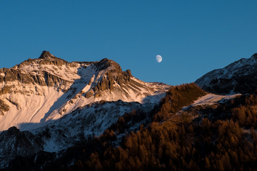
Once above 2000m it starts to get snowier. I also get above the tree line and thankfully the sky clears. The moon is out and lights up my snow covered track, it is a like walking on a silvery blanket, don’t even need my headlamp because of the reflection. There had been some human tracks in the snow early on, but as I get further up I share the track only with the mountain goats. Soon I am the only one breaking trail, the only sound being my boots trampling the snow, “crunch, crunch”, ankle to knee deep.
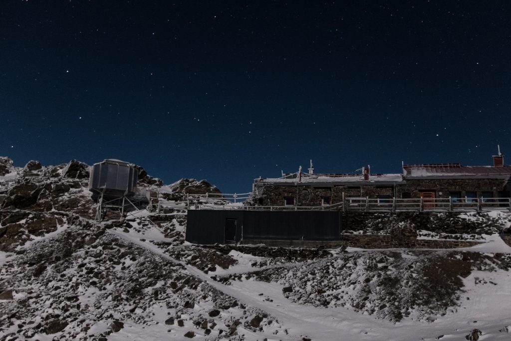
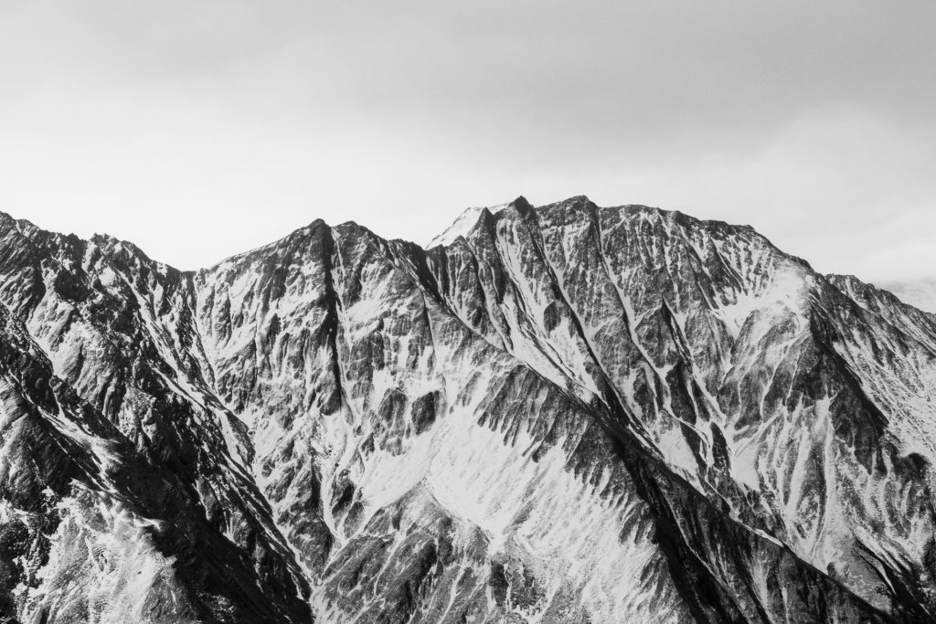
I reach the Glungezer hut (2610m) at 22:30. It is pretty damn cold and I am staying in the Roman’s Biwak. It is a small “hut” that is open, has a table and some beds with blankets, but no heating. I quickly set up my cooking stove, boil some water, have dinner and jump into bed as the temps keep dropping!
Day 2: Tuesday 31.10.17 – Glungezerhütte to Peeralm
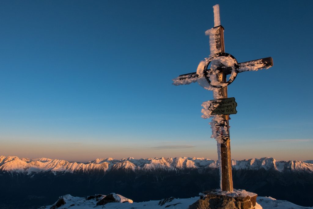
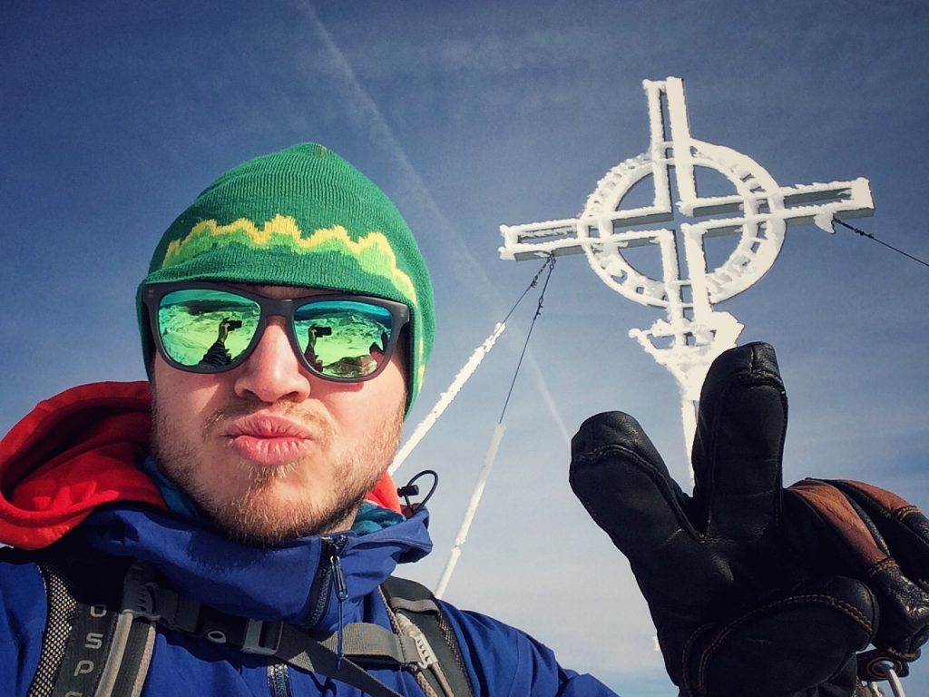
The alarm goes off at 06:30. I am pretty warm in my sleeping bag and blanket cocoon, though as I crawl out it is surprisingly warm in the room. I throw on my puffy jacket and slip into my somewhat frozen hiking boots. The sun has not yet come above the horizon as I make my way up to the nearby Sonnenspitz (2639m). It is pretty amazing to be all alone this high up, experiencing the rays of the sun as they start lighting up the highest peaks and crawling down into the valley.
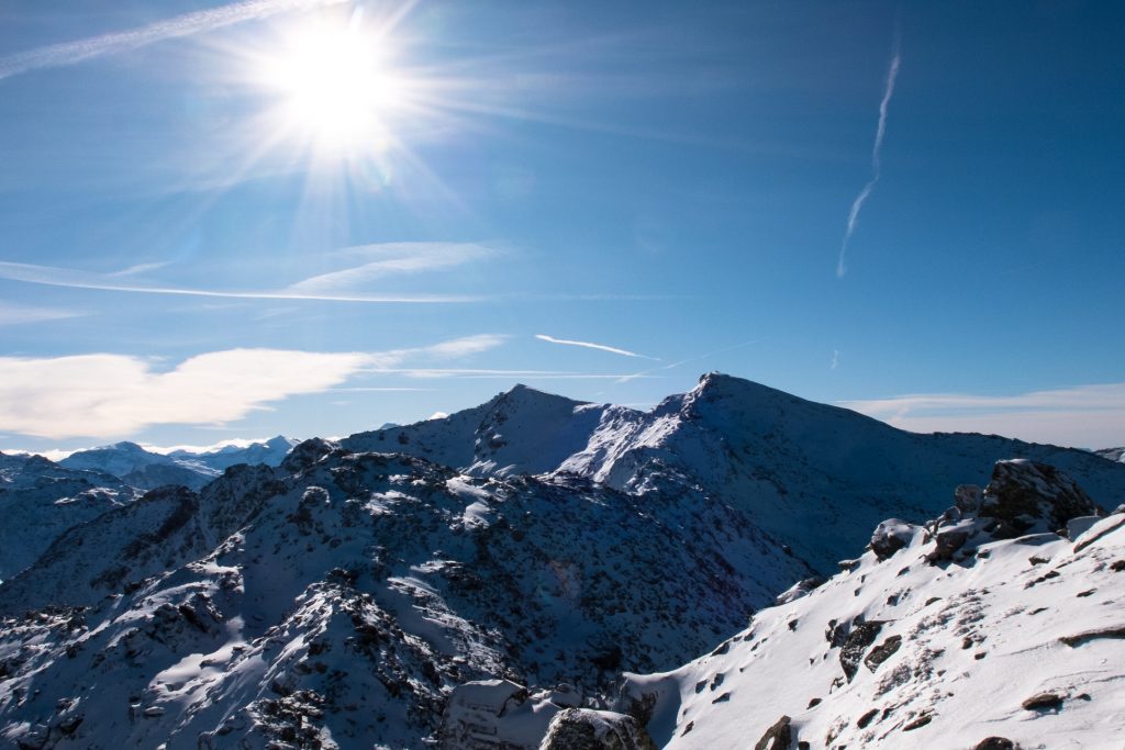
Once I have enjoyed the view for a time and gotten some pictures I go back to the biwak to make breakfast and melt snow for water. I head out packed and ready at 08:15, making my way up to the Glungezer (2677m) and continuing on over the ridgeline heading South. It is a clear super sunny day! There is quite a bit of snow and traversing this part is like playing Minesweeper as each step in the snow could plunge my feet into a deep crack between the rocks. I try as much as I can to stay on the rocks and carefully walk in the snow, though sometimes I am swallowed whole down to my waist, falling head first into the snow and feet stuck between the rocks. It gets old quick.
I reach Kreuzspitze (2746m) at 11:30 and continue on to Rosenjoch (2796m), after which the track seems to be getting better. Trying to navigate in this snow covered landscape isn’t so easy though and sometimes I just make my own track according to where I feel is most logical to walk, it usually leads me back on the marked track anyways. Naviser Jöchl (2479m) is my last high point before needing to head down into the Navis valley. I start my descent at 15:00 and soon reach the Grafmartalm (2162m). It is a nice place with running water and place to sit in the sun, so I take out my cooker and boil some water to have a very late lunch.
The sun is setting soon and I need to find a place to stay for the night. It starts getting pretty dusky around 17:00 and nearby Peeralm (1663m) I find a little collection of trees with a stream running nearby. I figure this is a good spot to biwak for the night. I am however spotted in the woods by a local, damn my orange sweater, and they come by to ask me what I am doing. I simply greet them and tell them that I am just a crazy Icelandic man looking to sleep outside for the night. They crack a joke about me escaping Iceland because of the newly held elections, nice and not so nice that it is getting worldwide attention. They seem to be just worried about me not freezing for the night, but I assure them that I have everything needed to survive. They see that I am a decent guy and speak their language so they simply wish me good luck.
I cook dinner, set up my sleeping arrangements on a narrow stretch of flattish ground and try to eat some terrible pasta, thankfully I am saved by a bar of chocolate and a small bag of chips. I cook up a liter of water, fill my Nalgene water bottle and throw it at the bottom of my sleeping bag (best cold camping tip ever) to keep my toes warm for the night. The moon and starts are out as I sleep under the open sky!
Day 3: Wednesday 01.11.17 – Peeralm to Schmirn
I wake up early, not really needing the alarm. This has not been the most comfortable night sleeping out I have ever had, but it worked, I got some hours of sleep. I make my breakfast at around 07:00, same thing as practically every trip, the golden standard of hiking breakfasts, oatmeal.
All packed up and ready to roll, semi frozen boots strapped on and I ogle the map one more time to find the best route to hike to my next destination. The best way is to walk a few kilometers on the flat, keeping the same elevation, to reach the other side of the valley. After that the climb up begins. Roughly 1000m of elevation need to be gained to reach the top of the next range and then I need go down the same elevation. Thankfully the snow and landscape isn’t as bad as the previous day, more pastures and less crumbled rocks. I can actually follow some sort of a track for a time.
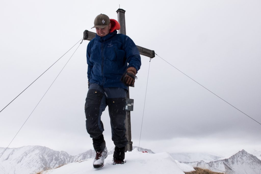
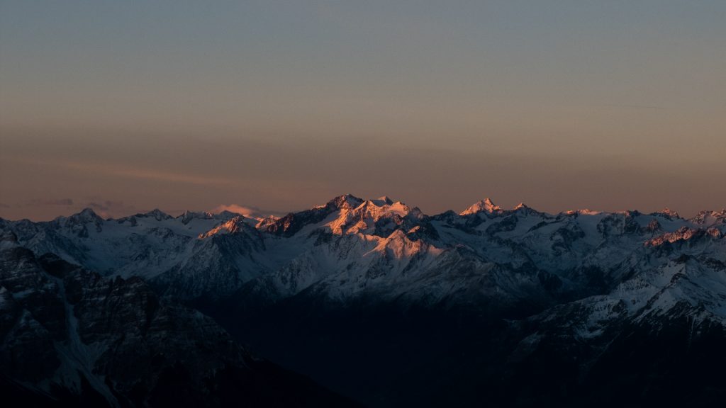
I reach Naviser Kreuzjöchl (2536m) just before 12:00 and the weather isn’t playing nice. Today started out gray and cloudy, quite a stark difference from yesterday, but on the top it actually starts snowing a bit. I decide not to stick around for too long and make my way down to what seems to be a collection of huts at the valley floor. The surrounding mountains however stop me for a second with their artistic shape and beauty so I need to take a couple snap photographs.
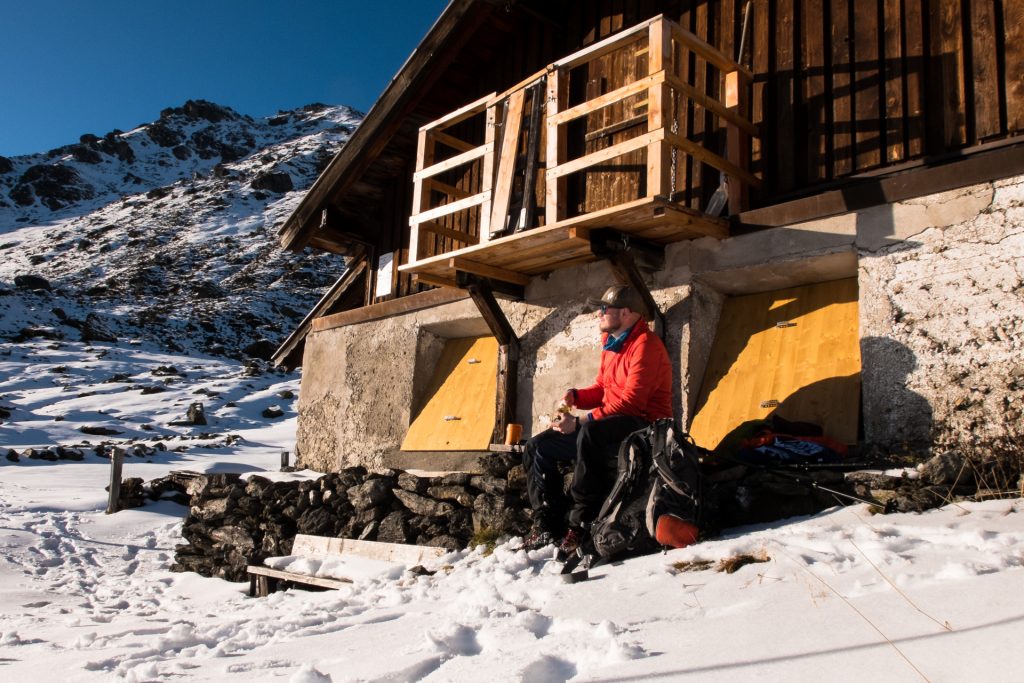
Once at the valley floor I find this nice little hut called Florian hut (1850m), a secret little hut not really marked on the maps. There are places to sit and a stream running right next to it. I have been feeling the soles of my feet giving me problems for quite a while now and they need a rest. I once again grab out my trusty cooker, boil some water and have a great feast of a lunch.
Evaluating my circumstances I look at the trail ahead and what route I had planed to take. Originally I wanted to stay out another day, but I realize that I won’t be able to do it; my feet are too banged up. Must be from my heavy backpack that has put quite a strain on the soles of my feet. I would have to hike quite a few kilometers on flat valley roads and then up another 1000m in the snow before eventually reaching a hut where I could stay the night.
I decide that is not the right thing to do, my mind and fitness levels are OK, technically I can do it on sheer strength of will, but for the sake of my feet I decide to end the hike there. I walk out of this magical little side valley into the larger Schmirn valley. I know that I should be able to catch a bus somewhere there to a train station at the end of the valley, there I could ride the train back to Innsbruck.
Looking at the bus sign I see that there is at least an hour and a half of waiting for the next bus. Instead of doing that I decide to walk a bit on until I reach the town of Schmirn, where I take another look at the bus schedule. I remember that it is a public holiday today and in the fine print it says that the bus doesn’t run during public holidays. I realize that I won’t be able to walk out of the valley, not with those feet and the distance to the train station. The only thing I can do is stick my thumb out and hope someone gives me a ride.
What luck! First car that passes by, within a minute of deciding to hitchhike, I get a ride. It is a grandfather with his grandson, heading to Salzburg and they can give me a ride all the way to Innsbruck. Perfect! To make it easy, as they need to stay on the Autobahn, they drop me off at the gas station nearest to Innsbruck. From there I simply walk home, where a super well deserved cold Radler is waiting for me in the fridge! Overall I am pretty happy with my efforts…
Rough totals:
Ascend: 3480m
Descend: 2970m
Distance: 41km
Peaks along the way:
Sonnenspitze 2639m
Glungezer 2677m
Gamslahnerspitze 2681m
Kreuzjöchl 2575m
Keuzspitze 2746m
Rosenjoch 2796m
Grünbergspitze 2790m
Grafmartspitze 2720m
Naviser Jöchl 2479m
Naviser Kreuzjöchl 2536m